高德地图 Javascript API 入门(三)
距离测量插件
区别
虽然鼠标工具插件也提供距离量测功能,
但是距离量测插件,提供更为丰富的样式设置功能。
加载插件
JS
1 | map.plugin(["AMap.RangingTool"],function () { |
预览
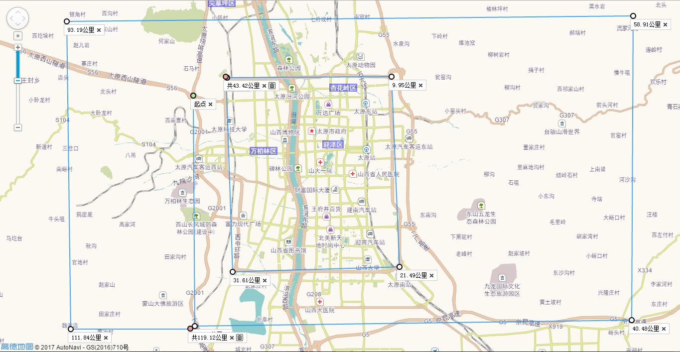
image
样式设置
RangingToolOptions | 类型 | 说明 |
|---|---|---|
|
| 设置量测起始点标记属性对象,包括点标记样式、大小等,参考 MarkerOptions 列表 |
|
| 设置量测中间点标记属性对象,包括点标记样式、大小等,参考 MarkerOptions 列表 |
|
| 设置量测结束点标记属性对象,包括点标记样式、大小等,参考 MarkerOptions 列表 |
|
| 设置距离量测线的属性对象,包括线样式、颜色等,参考 PolylineOptions 列表 |
|
| 设置距离量测过程中临时量测线的属性对象,包括线样式、颜色等,参考 PolylineOptions 列表 |
|
| 设置量测起始点标签的文字内容,默认为“起点” |
|
| 设置量测中间点处标签的文字内容,默认为当前量测结果值 |
|
| 设置量测结束点处标签的文字内容,默认为当前量测结果值 |
| 设置量测起始点标签的偏移量。默认值:Pixel(-6, 6) | |
| 设置量测中间点标签的偏移量。默认值:Pixel(-6, 6) | |
| 设置量测结束点标签的偏移量。默认值:Pixel(-6, 6) |
示例
改变标签文字
JS
1 | map.plugin(["AMap.RangingTool"],function () { |
预览
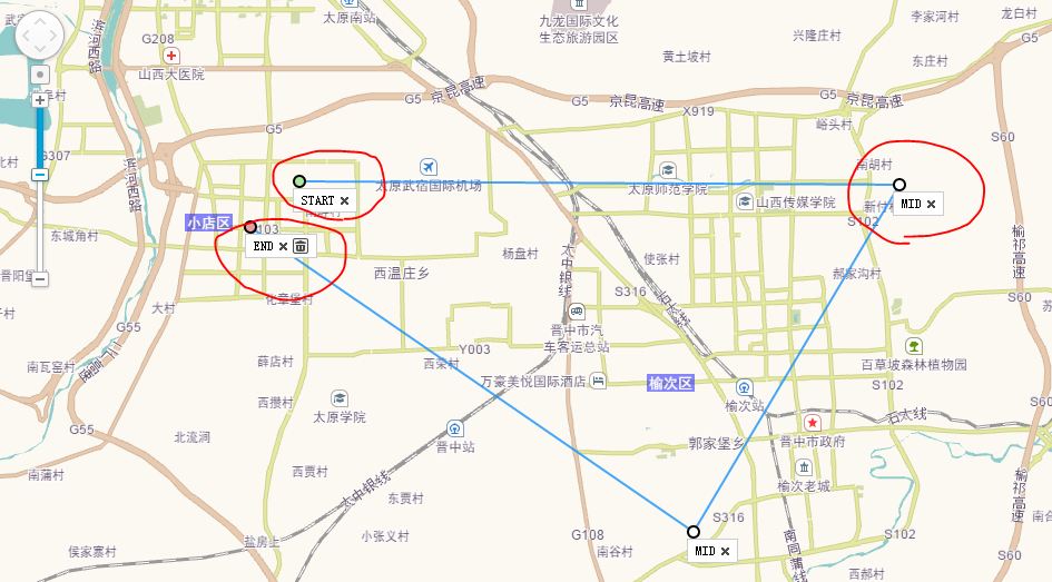
image
改变线条样式
JS
1 | map.plugin(["AMap.RangingTool"],function () { |
预览
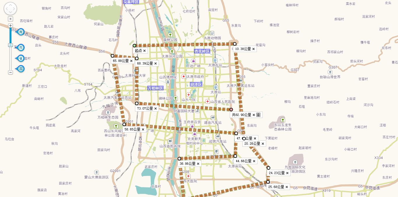
image
小练习
绘制太原市区的大概范围
JS
1 | // 用坐标拾取器获得坐标 |
预览
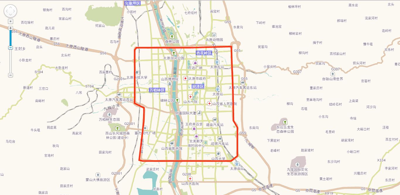
image
参考来源:http://lbs.amap.com/
作者:Yangfan